River Facts
Located in eastern Massachusetts, the Sudbury, Assabet, and Concord (SuAsCo) rivers collectively drain a 399-square-mile watershed that flows northward into the Merrimack River at Lowell. From there, the water flows eastward and enters the Gulf of Maine at Newburyport/Plum Island.
Sudbury River Facts


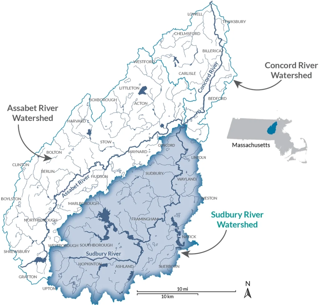
The Sudbury River’s headwaters are in Cedar Swamp in Westborough. The 1,650-acre Cedar Swamp was the first Area of Critical Environmental Concern designated in Massachusetts in 1975. The river then flows through towns, over dams, and through Great Meadows National Wildlife Refuge in Sudbury. Lake Cochituate and the Sudbury Reservoir are tributaries to the river. The eastern part of the watershed is part of the MetroWest Boston region. The last 16.6 miles are federally designated as Wild & Scenic.
Recreational Activities

River Length, Watershed Area, and Wild & Scenic Status

Geographical and Political Boundaries

Major Tributaries and Dams

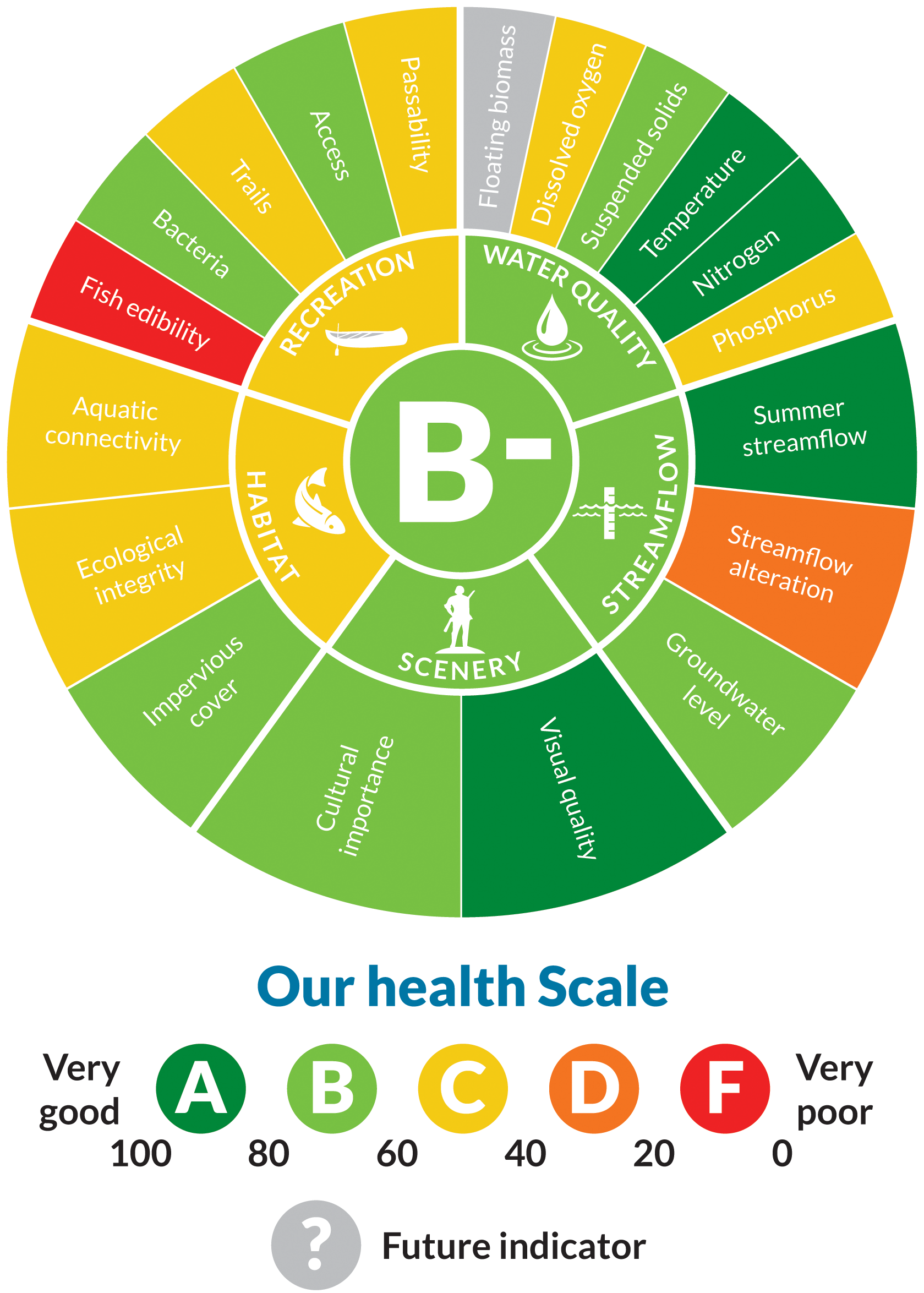
Water Quality

Assabet River Facts


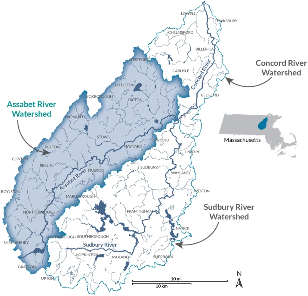
The Assabet River has had many names over the centuries. The name “Assabet” comes through the filter of time from the (spoken) Algonquin word for “the place where materials for making fish nets come from.” You will also see it referred to as the Assabeth, Asabet, Elizabeth, Elizabet, and other variations as different cultures named the landscape. The river starts just above the Nichols Dam in Westborough, flows through several mill towns, past orchards and fields, along the Assabet River National Wildlife Refuge in Stow, and meets the Sudbury River in Concord. The Assabet River Rail Trail runs along much of its length. The last 4.4 miles are federally designated as Wild & Scenic.
Recreational Activities

River Length, Watershed Area, and Wild & Scenic Status

Geographical and Political Boundaries

Major Tributaries and Dams

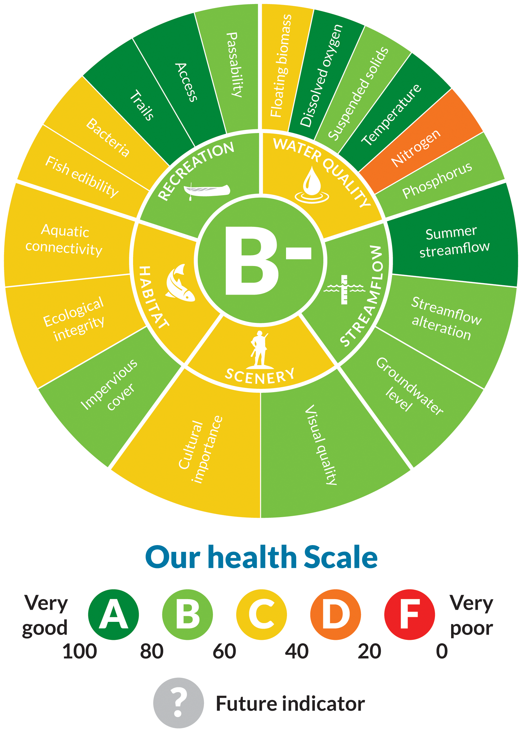
Water Quality

Concord River Facts


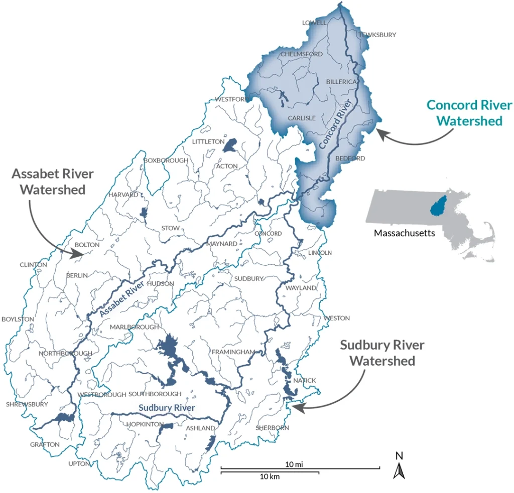
The Concord River is formed by the confluence of the Assabet and Sudbury rivers at Egg Rock in Concord. It flows north past The Old Manse, through Minute Man National Historical Park in Concord, and under the famous North Bridge. From there, it meanders through the Concord unit of the Great Meadows National Wildlife Refuge, Carlisle, and Bedford, and joins the Merrimack River in Lowell. Other sites to visit include the Middlesex Canal Museum in North Billerica, Two Brothers Rocks in Bedford, the Concord River Greenway and canals in Lowell, and Lowell National Historical Park.
Recreational Activities

River Length, Watershed Area, and Wild & Scenic Status

Geographical and Political Boundaries

Major Tributaries and Dams

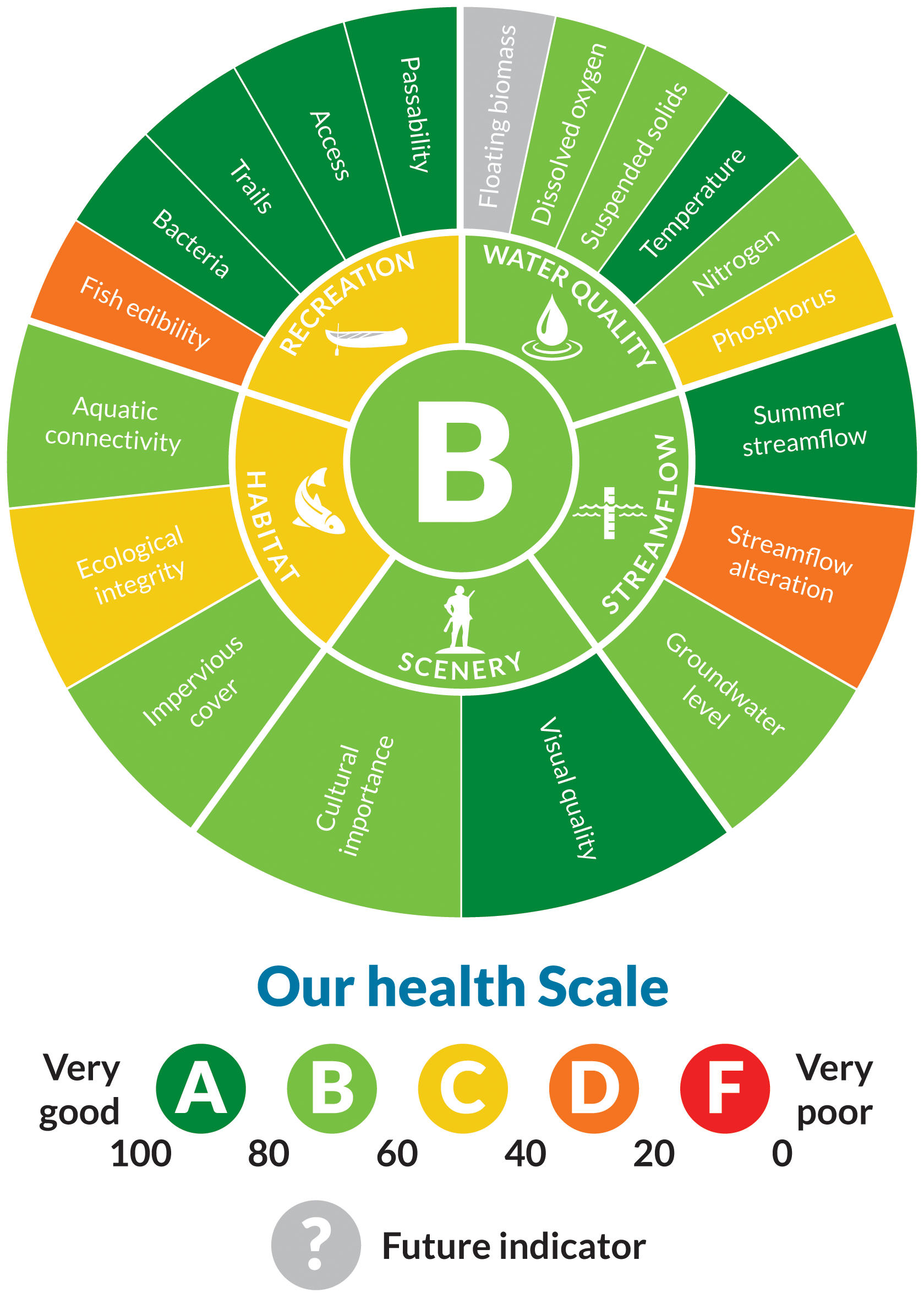
Water Quality

Threats
Centuries of strain on our rivers jeopardize water quality and flow, threatening our communities, wildlife, and water supply
LEARN MORERECREATIONS MAPS
Recreational guides for Sudbury, Assabet, and Concord rivers are available as a series of single-river maps and as an interactive online map
RECREATON MAPSRiver Science
Read our latest findings on water pollution and work to build climate resilience
UNDERSTANDING OUR RIVERS’ HEALTHEcological Restoration
Removing defunct dams, managing invasive species, and more to restore the natural ecology and free flowing nature of rivers
LEARN ABOUT ECOLOGICAL RESTORATION
